US 50 -- West Virginia
Copyright 2010 W. Berg Press
Welcome to West Virginia -
The capital is Charleston.
State motto is: Mountaineers are Always Free.
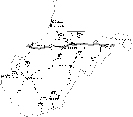
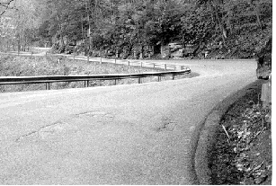
Once we enter West Virginia, US 50 winds and climbs through mountain
ranges. Many signs along the road show recommended speed limits of 30 mph and 40 mph. Some
mountain tops reach over 1,000 feet. Bear Mountain is 1,057 feet. From here it goes down
to Capon Bridge village where we cross the Cacapon River. Then the road goes back up to
1,265 feet and down again, and up again to 1,607 feet.
Romney, West
Virginia, claims to be the oldest town in the state. The ‘Potomac Eagle’
excursion train departs from here. A ride along the South Branch of the Potomac River
gives easy access to view birds of prey, including osprey and eagles.
At Gormania we cross back into Maryland for a short time. We must climb to the highest
elevation of the road system for the state of Maryland. Backbone Mountain is 3,090 feet
high.
Preston County is named after the thirteenth governor from Virginia. As we drive along
these mountain roads, we get a feeling that we are still in the Civil War times. We would
not be surprised to see Confederate soldiers on their way back to the South.
Before we reach Aurora, we pass by
Cathedral State Park. Majestic stands of hemlock and hardwood give a cathedral
feeling and show how it was before modern men came to the mountain. Hiking trails wind
through this forest of ancient trees that measure ten feet and more in diameter.
We stop at Cool Spring Park and admire the old farming tractors that are on display. There
are some old steam engines used in early farming.
Next, we climb up Laurel Mountain, 2,602 feet elevation, and then down again. We notice
that most towns are unincorporated townships. The road is rough. We average about 20 miles
an hour. This is quite different from the five-lane US 50 that approached the District of
Columbia.
Grafton became a major throughway during the Civil War when the railroad established a
foothold in this town. Near Grafton is
Tygart Lake State Park. It has a lodge with 20 rooms. The rooms are very large
and built magnificently. They have 12-foot high ceilings with wooden interior walls and
ceilings. The restaurant overlooks the lake and serves superb meals at very reasonable
prices.
South of Tygart Lake State Park you find the oldest and longest covered bridge. If you
visit only one covered bridge, see Barbour County’s Philippi Bridge on US 119/250. It
is the only structure of its kind that is still part of the federal highway system. In
1861, Union and Confederate Soldiers fought the first land battle of the Civil War over
this bridge.
Grafton is an old city with a colorful history that prospered when the railroad came to
town in 1856. The Baltimore and Ohio (B&O) was the major employer for this area.
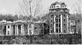
The Andrews Methodist Episcopal Church is the International Mother’s Day Shrine. Anna
Jarvis brought distinction to Grafton when she organized the first Mother’s Day
Celebration on May 10, 1908, at this church. The Anna
Jarvis Birthplace Museum is located Route 119 south of Webster.
Bridgeport is located at the junction of US 50 and Interstate 79 and has been a trading
post since 1764. Today it is a favorite stop where you can find hotels, a shopping mall
with 100 stores, and fast food varieties of your choice. There are more than forty
restaurants and eateries. From Bridgeport US 50 West is a four-lane divided highway.
In 1785 Clarksburg was
added to the map, named after George Rogers Clark, a Revolutionary War general,
who fought the British and Indians in the Northwest Territory. In 1803,
his younger brother William became a leader of the Lewis and Clark Expedition.
Clarksburg is also the birthplace of General Thomas “Stonewall” Jackson. Many
immigrant laborers came here after the Civil War. A heroic sculpture has been erected near
the court house that represents Belgian, Czech, Greek, Hungarian, Irish, Italian, Romanian
and Spanish immigrants. Europeans flocked to the region in the 1880s in search of the
American dream.
We drive to the
North Bend State Park in Cairo, West Virginia. Having been so impressed with
last night’s accommodations at the Tygart Lake Park, we decide to stay another night
at a West Virginia state park. Instead of sleeping at the lodge, we try out the campground
and sleep in our van for the first time. Our site was approximately 50 feet off the North
Fork of the Hughes River.
North Bend State Park offers many recreational facilities. A modern lodge with guest rooms
and restaurant is also available. While dining, one can view the surrounding mountains and
visiting wildlife. Near the park is the North Bend Rail Trail. Still under development,
the trail affords hiking and biking opportunities. It stretches for 61 miles from Wolf
Summit to Walker in Wood County. This scenic abandoned spur of the CSX railroad passes by
several quaint towns, through 12 tunnels and over 32 bridges.
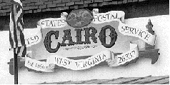
From North Bend we drive to Cairo. Cairo is a small hillside village way off the track.
The US Post Office in Cairo was established in the year 1856. It is still in the same
building today. I shop at Rowley’s General Store for breakfast. A scenic drive, that
is well worth taking, eventually gets us back to US 50.
In Parkersburg, visitors
have the opportunity to board an authentic sternwheeler at Point Park for travel to
Blennerhassett Island.
This tranquil, tree-covered island in the Ohio River is
the place where Blennerhassett and Aaron Burr allegedly conspired to establish a new
empire in the Southwest. Crossing the Ohio River brings us to Ohio.
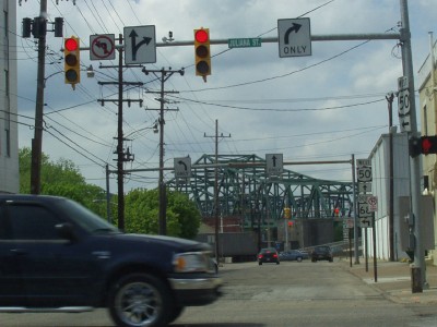
US 50 crossing Ohio from Downtown
Parkersburg
Chris Conner


